❄️ Do You Know… Google Earth Blurs Out Massive Regions of Antarctica?
admin
Author
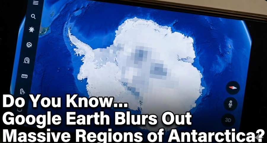
Most people use Google Earth to explore cities, jungles, oceans, and even the surface of Mars. Yet when you zoom into Antarctica — the last great frontier — something strange happens: huge portions of the continent are blurred, pixelated, erased, or covered with smooth white layers that look nothing like real satellite images.
Why would the coldest, emptiest place on Earth need digital censorship?
While other continents show mountains, valleys, forests, and even individual buildings in high resolution, Antarctica remains a patchwork of low-quality textures and obvious edits. The coastline looks real. But the deeper you go inland, the more the terrain becomes unnatural — flat panels, stretched textures, or blank white blocks.
Some regions are so blurred it’s impossible to tell whether mountains, structures, or entire landscapes exist beneath them.
Google claims Antarctica is simply “hard to photograph.”
But this explanation collapses immediately.
Google Earth displays crystal-clear images of:
-
The Sahara Desert
-
Greenland’s ice sheets
-
Arctic regions
-
Volcanic islands
-
Deep ocean coastlines
All of these are far more remote and difficult to photograph than Antarctica.
Yet only one continent is consistently blurred:
the one protected by the Antarctic Treaty — the world’s most heavily restricted landmass.
Coincidence? Or coordination?
Researchers have discovered suspicious anomalies:
-
Dozens of blurred rectangular zones
-
Structures with straight edges hidden under white overlays
-
Mountain ranges smoothed out unnaturally
-
Dark pixelated spots covering entrances, caves, or surface openings
-
Entire regions stitched with artificial textures
When asked, Google gives no clear answers.
If Antarctica is truly just a wind-blasted sheet of ice, why restrict what the public sees? Why would harmless terrain need censorship?
Even more curious: no civilian aircraft, satellite companies, or private explorers can freely gather their own high-resolution imagery. All satellite data of Antarctica funnels through a handful of government-approved channels.
The same governments that enforce strict no-fly zones around the continent.
The same governments that signed a treaty preventing anyone from living, mining, or conducting independent research there.
The same governments that keep the world’s last untouched landmass off-limits.
So what exactly lies beneath the blurred pixels?
Ancient ruins?
Massive entrances into underground structures?
Geological formations that contradict the globe model?
Evidence of past civilizations?
Something else entirely?
Until free, independent imaging becomes possible, Antarctica remains a digitally censored mystery — one the world is not allowed to explore, even virtually.
Google Earth shows the world.
But in Antarctica, it hides it.