Global Positioning System (GPS) technology has become an essential part of modern life, powering everything from smartphone navigation to aviation and maritime operations. While GPS works remarkably well in most populated regions, its accuracy noticeably decreases at high latitudes, especially near the Arctic and Antarctic. This is not a coincidence, nor a malfunction, but a result of how GPS satellites are designed, positioned, and affected by Earth’s environment.
Understanding this limitation requires looking at satellite geometry, orbital design, atmospheric behavior, and the physics of signal transmission.
How GPS Works in Simple Terms
GPS relies on a network of satellites orbiting Earth that continuously transmit time-stamped radio signals. A GPS receiver calculates its position by measuring how long these signals take to arrive from multiple satellites. The receiver needs signals from at least four satellites to determine an accurate three-dimensional position and correct timing errors.
The accuracy of this calculation depends heavily on the relative positions of the satellites in the sky, not just their number.
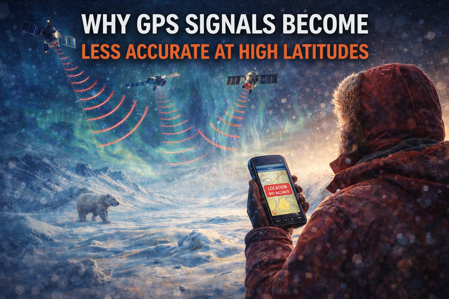
Satellite Geometry and Its Role in Accuracy
One of the most important factors in GPS precision is satellite geometry, often described using a metric called Dilution of Precision (DOP). When satellites are spread widely across the sky, location calculations are strong and reliable. When satellites appear clustered or low on the horizon, positional errors increase.
At high latitudes, GPS satellites tend to appear closer together from the receiver’s perspective. This clustering reduces geometric diversity, which directly increases positional uncertainty.
Why GPS Satellites Favor Mid-Latitudes
Most GPS satellites orbit Earth at an inclination of about 55 degrees relative to the equator. This design ensures optimal coverage for the regions where the majority of the global population lives.
As a result:
-
Satellite coverage is densest in mid-latitude regions.
-
Near the poles, satellites appear lower in the sky and move more rapidly across the horizon.
-
Receivers have fewer favorable satellite angles to work with.
This orbital configuration inherently limits performance near the polar regions.
Ionospheric Effects at High Latitudes
Another major factor is the ionosphere, a charged layer of Earth’s upper atmosphere that affects radio signals. GPS signals must pass through the ionosphere before reaching the receiver, and variations in ionospheric density can delay or distort these signals.
High latitudes experience:
-
Stronger ionospheric disturbances
-
Increased solar and geomagnetic activity
-
More frequent signal scintillation (rapid signal fluctuations)
These effects can cause timing errors that translate directly into location inaccuracies.
Signal Path Length and Low Elevation Angles
Near the poles, GPS signals often arrive at low elevation angles, meaning they travel longer paths through the atmosphere. Longer paths increase exposure to:
-
Atmospheric refraction
-
Multipath interference (signal reflections)
-
Environmental noise
Each of these factors contributes incremental errors that accumulate in the final position estimate.
Real-World Impacts of Reduced Accuracy
Reduced GPS accuracy at high latitudes affects several critical activities:
-
Aviation navigation over polar routes
-
Maritime operations in Arctic waters
-
Scientific research stations in Antarctica
-
Surveying and mapping in northern regions
To compensate, many of these applications rely on augmentation systems, alternative satellite constellations, or inertial navigation backups.
How Modern Systems Are Addressing the Problem
Newer global navigation satellite systems (GNSS) such as GLONASS, Galileo, and BeiDou use different orbital configurations, some with higher inclinations. Multi-constellation receivers that combine signals from multiple systems can significantly improve accuracy at high latitudes.
Additionally, ground-based augmentation systems and real-time correction services help mitigate atmospheric and geometric errors.
Conclusion
GPS accuracy decreases at high latitudes due to a combination of satellite orbital design, reduced geometric diversity, ionospheric disturbances, and longer atmospheric signal paths. These limitations are well understood within satellite navigation science and explain why GPS performs best in mid-latitude regions.
While GPS remains a powerful and reliable tool, its behavior near the poles highlights the importance of understanding technological boundaries and the environmental factors that influence global navigation systems.