Human navigation did not begin with satellites or digital maps. For most of history, people traveled vast distances using nothing more than observation, memory, and environmental awareness. Over time, navigation methods evolved as technology advanced, gradually shifting from natural references to mechanical instruments and finally to space-based systems.
This timeline explains how navigation changed across different eras and why each stage mattered.
Phase 1: Natural Navigation (Before 1000 BCE)
The earliest navigation relied entirely on nature. Travelers followed:
-
The position of the sun during the day
-
The movement of stars at night
-
Coastlines, rivers, and landmarks
Early humans memorized routes rather than calculating positions. Navigation was local, experience-based, and dependent on familiarity with the environment.
Phase 2: Celestial Navigation (1000 BCE – 1500 CE)
As sea travel expanded, sailors began systematically using the sky for navigation. This period marked the rise of:
-
Star-based direction finding
-
Latitude estimation using star angles
-
Seasonal navigation routes
Celestial navigation allowed long-distance sea travel and made early global trade possible.
Phase 3: Instrument-Based Navigation (1500 – 1800)
The development of navigation instruments transformed accuracy. Tools such as:
-
Astrolabes
-
Quadrants
-
Sextants
enabled sailors to measure angles precisely. Combined with timekeeping advances, navigators could calculate latitude more reliably, though longitude remained difficult to determine.
Phase 4: Mechanical and Chart Navigation (1800 – 1950)
During this era, navigation became more standardized. Advances included:
-
Accurate marine chronometers
-
Detailed nautical charts
-
Compass improvements
Navigation shifted from skill-based intuition to calculation-based methods, increasing consistency and safety in travel.
Phase 5: Radio and Electronic Navigation (1950 – 1980)
Before satellites, radio signals played a key role. Systems such as:
-
Radio beacons
-
Direction-finding antennas
-
Ground-based navigation aids
allowed ships and aircraft to determine position using signal timing and direction, though coverage was limited and region-specific.
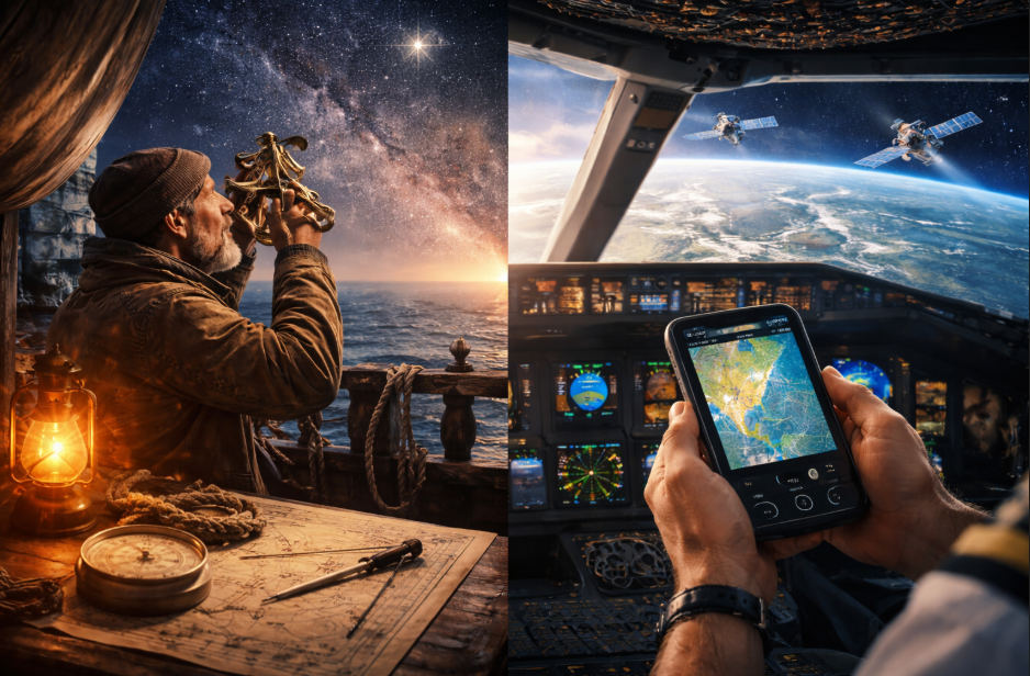
Phase 6: Satellite Navigation (1980 – Present)
Satellite navigation introduced global positioning through space-based systems. By measuring signal timing from orbiting satellites, receivers could calculate location with unprecedented precision.
However, satellite navigation still depends on:
-
Orbital geometry
-
Atmospheric conditions
-
Ground control infrastructure
While highly effective, it is not flawless or uniform everywhere on Earth.
What This Evolution Reveals
Navigation has never relied on a single method. Each stage built upon previous knowledge while introducing new limitations. Even modern systems retain dependencies on physical laws, environmental conditions, and supporting infrastructure.
Understanding this progression helps explain why no navigation system is ever completely independent or perfect.
Conclusion
From reading stars to receiving satellite signals, navigation has evolved through centuries of experimentation, observation, and innovation. Modern systems may feel effortless, but they are the result of layered knowledge built over thousands of years.
This history shows that navigation is not just a technological achievement, but a reflection of humanity’s ability to adapt to the world using both nature and science.