Ash and Empire: The Hidden Roads of Pompeii That Vanished Under Vesuvius
admin
Author
1. Pompeii before the Ash
By the mid–1st century CE, Pompeii had blossomed into a bustling port and resort town on the Bay of Naples. Its grid of stone-paved streets connected villas, workshops, markets, baths, and temples—linking local farms to the wider Mediterranean via the Via Popilia and coastal quays. Residents and merchants moved along these arteries daily, fueling an economy that blended Campanian agriculture with imports from across the Empire.
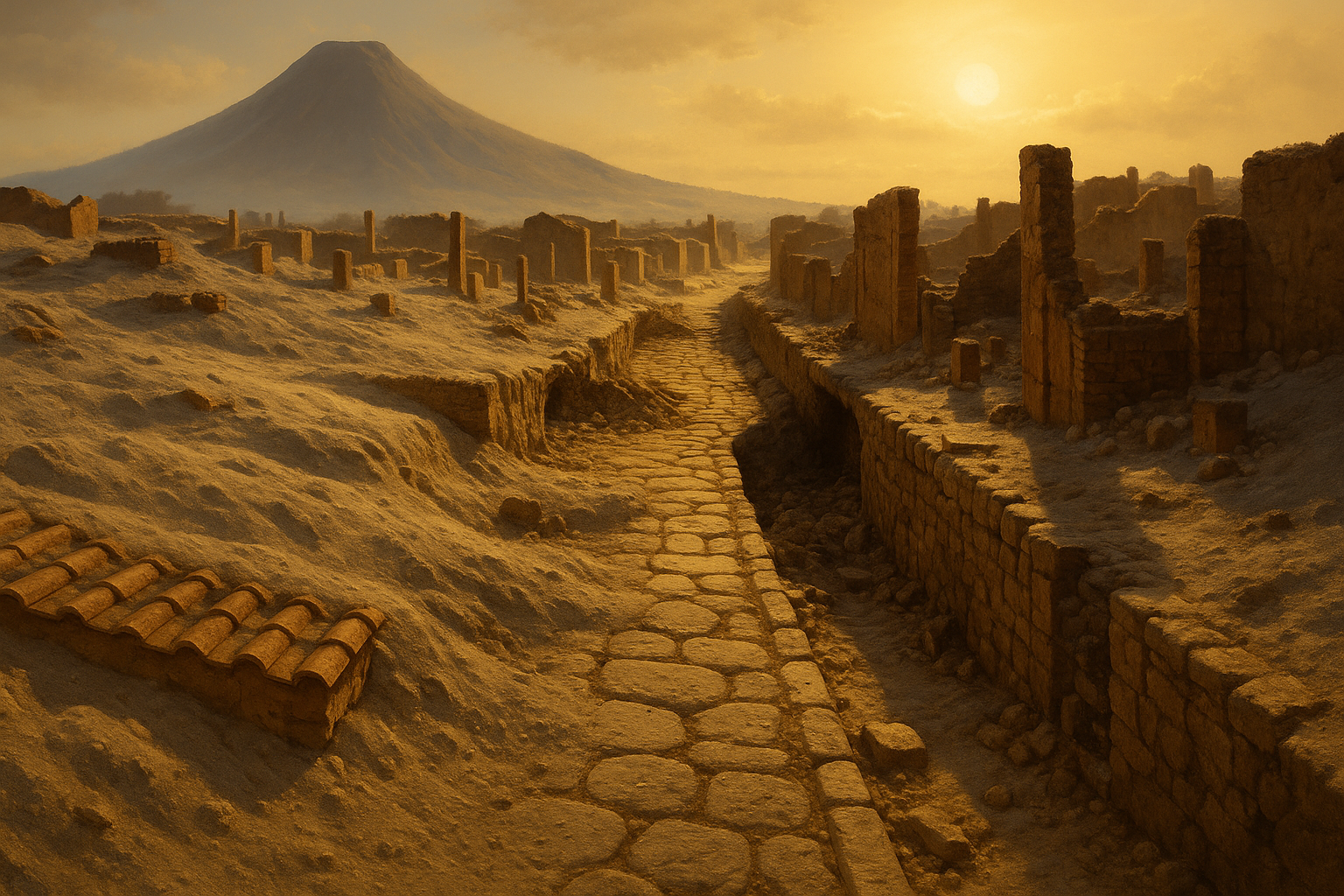
2. Vesuvius’s Cataclysmic Silence
On August 24, AD 79, Mount Vesuvius unleashed a pyroclastic surge that smothered Pompeii under up to six meters of ash and pumice within hours. In the frantic flight and final moments of the eruption, the city’s well-worn roads were buried, leaving only rooftops and treetops visible in the fallout. Over centuries, wandering shepherds and later excavators focused on grand villas and frescoed houses, while many side-streets and minor thoroughfares remained unexplored.
3. Unearthing the Lost Network
Recent advances in geophysical surveying—ground-penetrating radar (GPR) and electrical resistivity tomography (ERT)—have mapped subsurface stone alignments far from known excavations. Key discoveries include:
-
Via della Fortuna Minor: A mid-block connector between the Forum and the Via dell’Abbondanza, found three meters below modern ground level.
-
Decumanus Boulevard Extensions: Hidden western spurs leading toward amphitheater service quarters.
-
Farm-Track Conduits: Narrow lanes linking vineyards on Pompeii’s slopes to the city gates.
Field teams have since exposed pavement edges, wheel-rut grooves, and raised pedestrian sidewalks, confirming these lanes once teemed with wagons, pedestrians, and pack animals.
4. Roads as Arteries of Empire
In Roman urban design, streets were far more than routes—they were instruments of social order and imperial control:
-
Economic Lifelines: Roads facilitated the rapid movement of olive oil, wine amphorae, garum fish sauce, and imported luxury goods.
-
Military Logistics: Messengers and patrols used secondary routes to maintain law, levy taxes, and inspect grain stores.
-
Civic Rituals: Processions and public ceremonies followed designated ceremonial roads, reinforcing civic identity under the emperor’s authority.
5. Daily Life along the Hidden Ways
Excavated sidewalks reveal stepping-stone crossings, where pedestrians navigated stepping slabs to avoid street runoff. Inscriptions painted on curbstones directed visitors to nearby workshops or taverns. Archaeobotanical samples from road-side drains show grape pips and olive pits—evidence of street-vendor stalls. Even graffiti scratched into kerbstones hint at lost jokes, declarations of love, and political endorsements.
6. Conservation and Interpretation
Preserving these newly revealed roads poses challenges: ash-encased pavements are fragile once exposed. The Pompeii Conservatory Authority has implemented:
-
Protective Shelters: Temporary overhangs to shield intact road segments from rain and sun.
-
3D Documentation: Laser scanning each stone block to guide future restorations and virtual reconstructions.
-
Interactive Trails: Signposted walking routes that integrate hidden thoroughfares into the visitor experience without endangering them.
7. Legacy of the Buried Streets
As we peel back layers of volcanic ash, Pompeii’s hidden roads remind us that cities are living organisms—networks of connection that endure through disaster and time. These long-forgotten lanes enrich our understanding of Roman daily life, imperial infrastructure, and the resilience of urban communities. In following their courses, we retrace footsteps frozen in ash—reborn now, under the southern Italian sun.